
New ALTA/NSPS Survey Standards
NSPS adopted the new 2021 Minimum Standard Detail Requirements for ALTA/NSPS Land Title Surveys on Friday 10-30-2020. These new Standards become effective 02-23-2021.
ALTA/NSPS surveys are land title surveys that assess the boundaries, titles and improvement locations of a property. It meets the needs of a title insurer to remove the standard survey exceptions from the existing title policy while showing improvements, encumbrances, rights-of-way, and any other items that may affect the property. These are demanding surveys that incorporate comprehensive checklist requirements and associated certifications.
From the NSPS website, some of the changes include:
- Address of the term "shall", which in many cases has been replaced with "must" (based upon the outcome of a 1995 U.S. Supreme Court case)
- Clarification that surveyors may provide objective information on rights of way, easement, or survey related matters
- Elimination of the requirement that surveyors determine if an abutting street or road is public
- The introductory paragraph of "Table A" now clarifies its original intent that the wording of a "Table A" item may also be negotiated, in addition to whether the item will be included and the associated fee
- Clarification that the zoning information specific to the surveyed property must be provided to the surveyor
- Simplification with the aim of trying to better manage client's expectations related to the ability of the surveyor to show underground utilities
- The wetlands item has been eliminated from "Table A
Proposed Revisions to RIDEM Wetland
RIDEM has proposed revisions to the wetland regulations governing jurisdiction and conduct in and around the state's wetland areas.
These amendments are "aimed at strengthening wetlands protections, provided clarity and predictability and streamlining the permitting processes for development and other activities conducted in proximity to freshwater wetlands."
Carlson GIS Image Import
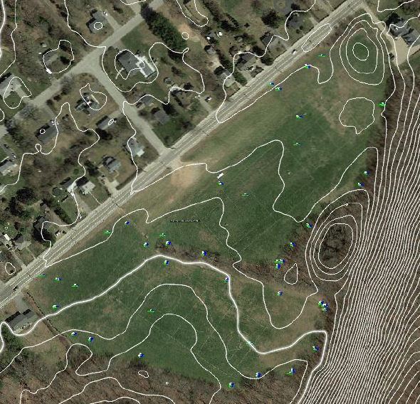
A great feature that we've been using in Carlson 2021 GIS is the "Import Image" command. This feature allows the importation of a variety of images, such as a Google image, directly onto your site (provided that your project is referenced to the correct horizontal datum).
This example is a recreational complex with a Google Earth image attached to the project. Note also 2011 2-foot LiDAR contours.
Cool stuff!
Photogrammetry vs. LiDAR
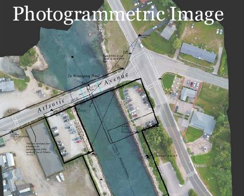
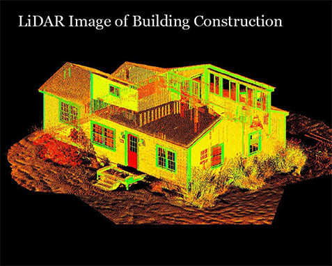
Land surveyors and geospatial professionals use photogrammetry and LiDAR (light detection and ranging) in a variety of visual mapping and land survey documentation projects. Both technologies can often produce similar output, though they are really quite different in the methodologies that they employ.
Photogrammetry is the science of using photographs to make reliable measurements between objects. Using a series of photogrammetry photos, users can recreate geometric representations of the photographed objects.
Aerial photography is one of photogrammetry's most common mediums to obtain photogrammetric images. However, photogrammetry can also apply to interior structures. In photogrammetry applications, overlapping photos, from at least two or more vantage points, help establish depth and perspective. Data is then converted to a point or set of data points.
LiDAR uses lasers to accomplish many of the same tasks as photogrammetry, and the technology behind LiDAR is similar to how radar uses radio waves. In LiDAR applications, rapid pulses of laser light are fired at a surface, in some cases at a rate of 150,000 pulses per second. A LiDAR sensor measures the amount of time it takes each pulse to bounce back from the earth's surface to the LiDAR instrument. This process is repeated in rapid succession until the LiDAR captures a map of the land area it is measuring that meets the degree of detail that the surveyor requires. A point cloud is then generated.
Northeast Virtual Conference Announced
The International Erosion Control Association (IECA) Northeast Chapter strives to bring together stakeholders interested in protecting the water and wetlands in New York and the New England states.
The theme of our three-day event conference (to be held November 17th - 19th 2020) is to build a better site management toolbox. The conference begins with a panel discussion on the future vision for our chapter, and the next two days include six live presentations and several on-demand sessions.
November 17:
Panel Discussion: A Vision for The Future: The Northeast Chapter of the International Erosion Control Association
November 18:
Restoration at Solar Development Sites: Opportunities for Pollinator & Habitat Restoration Following Construction
How to Design Stormwater Management for Ground Mounted Solar Arrays
Erosion and Sediment Control Matter in Green Infrastructure Too!
November 19:
Case Studies and Lessons Learned Using Three Dimensional Stabilization.
Sediment Control on Construction Sites
Northeast IECA Annual Meeting
Innovations in Drainage Technology
Register Now: https://ehub.ieca.org/p/Northeast2020

FEMA NFIP Technical Bulletin 1 (2020)
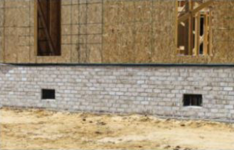
The much-anticipated revision of TB-1 has been released as of March 2020. "This document provides guidance on the factors related to the importance and proper application of having openings in the walls of enclosures (crawlspaces) beneath a structure."
"Without openings, flood waters outside of the structure transmit a tremendous amount of hydrostatic pressure on a foundation wall. The flood-opening requirements are intended to equalize hydrostatic forces on walls, thus preventing damage to or collapse of the building." - American Surveyor, 07-12-2020
Strange Stuff in Surveying
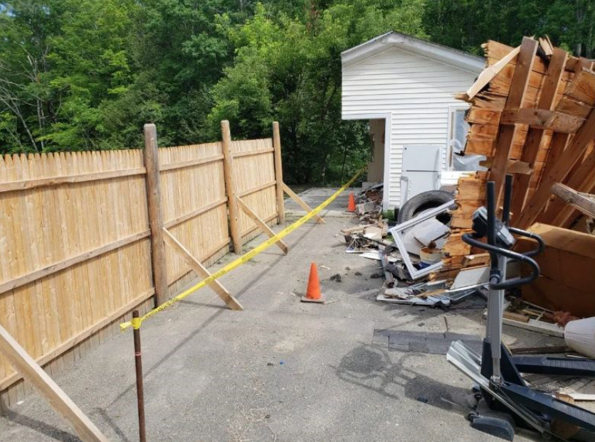
A Maine property owner used a land surveyor's demarcation between two lots as a guide to remove the half of the building sitting on his land when a dispute over the boundary line boiled over.
Dover-Foxcroft police Chief Ryan Reardon indicated he was aware of the situation and believes the dispute has been resolved at this point. - Bangor Daily News, July 2020
Survey Monumentation and Markers
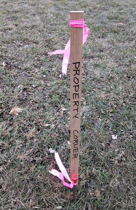
An important component of a boundary survey is the placement of monumentation and/or markers. These physical elements represent the land surveyor's expression of his/her final decision on the ground.
Monuments are defined (Rhode Island 9.8.1) as "...physical objects of reasonable longevity and permanence..." and include stone/concrete bounds, metallic disks, drill holes, iron pipes or rods, and foundation/building corners used as offsets.
Markers includes nails, wooden/plastic stakes and other materials "...possessing a similarly limited life span."
Different types of surveys have different monumentation requirements. For example, a Comprehensive Boundary Survey requires that monuments be established at not less than 70% of all corners and no point on a boundary shall be located more than 500 feet from a monument. Data Accumulation Surveys, by contrast, only required that control lines or points shall be marked with physical monuments set in a manner providing a degree of permanence consistent with terrain, physical features and purposes of the survey.
It should be noted that it is illegal to disturb or remove survey monuments or markers in most states. In Rhode Island, RIGL 11-44-11 entitled Injury to boundary or line markers, states “Every person who shall willfully break down, remove, injure, obscure, or destroy any monument erected for the purpose of designating the boundaries of any town or city or any tract or lot of land, or any tree marked for that purpose, or any stake set up to mark the line or grade of any railroad, or any marker erected for the purpose of designating a public right-of-way to water areas of the state, shall be imprisoned not exceeding one year or be fined not exceeding five hundred dollars ($500).”
My experience in this regard is that one must actually see the "injury" to the marker take place in order for any legal action to be initiated.
Also worthy of note is that land surveyors do not typically remove other monuments or markers that they may discover during the course of their boundary work, regardless of whether they are found to be in the true location or not.
Smart Construction
Komatsu, a manufacturer of heavy construction equipment, and Skycatch, a drone manufacturer, have announced a new service to automate pre-foundation work on construction jobsites. The new service is dubbed Smart Construction and pairs Skycatch drones with Komatsu machines equipped with intelligent Machine Control technology. In a nutshell, Smart Construction performs an initial terrain survey and compiles it into a 3D model. It then sends the data to the properly–equipped machines to carry out site preparation tasks. - RPLS Today.

Handheld GPS Units and Surveying
Many times clients come to us with surveying issues prefaced by the fact that they've already "surveyed" their property with their handheld GPS (Global Positioning System) or their smartphone's GPS.
Inevitably, this leads to some free public education time on the accuracy/precision of GPS generally and the accuracy/precision of handheld GPS units specifically.
"GPS satellites broadcast their signals in space with a certain accuracy, but what you receive depends on additional factors, including satellite geometry, signal block-age, atmospheric conditions, and receiver design/features/quality.
For example, GPS-enabled smartphones are typically accurate to within a 16-foot radius under open sky. However, their accuracy worsens near buildings, bridges, and trees." [GPS.gov] So a 16-foot radius yields a potential solution of 32 feet! Commercial grade handheld units available from commercial retailers, typically designed for recreation or general commercial use, can have a horizontal accuracy of between 3 and 10 meters (depending upon the type of signal being received). [USGS.gov)
"High-end users boost GPS accuracy with dual-frequency receivers and/or augmentation systems. These can enable read-time positioning with a few centimeters, and long-term measurements at the millimeter level." (GPS.gov)
A note on Selective Availability. When we first began using GPS technology, " ... GPS employed a feature called Selective Availability that intentionally degraded civilian accuracy on a global basis. In May 2000, at the direction of President Bill Clinton, the U.S. government ended its use of Selective Availability in order to make GPS more responsive to civil and commercial users worldwide. The United States has no intent to ever use Selective Availability again". (GPS.gov)
In the surveying world, where inches matter, clearly accuracy in the order of 30 feet is not acceptable. So next time you think about using that smartphone to "survey" your property, think twice about your solution.

NE IECA Board of Directors
Al has recently been elected to serve on the Northeast Chapter of the International Erosion Control Association Board of Directors as the Rhode Island representative.
The IECA is a non-profit, member organization that provides education, resource information and business opportunities for professionals in the erosion and sediment control industry.

New Reference Frames Coming in 2022
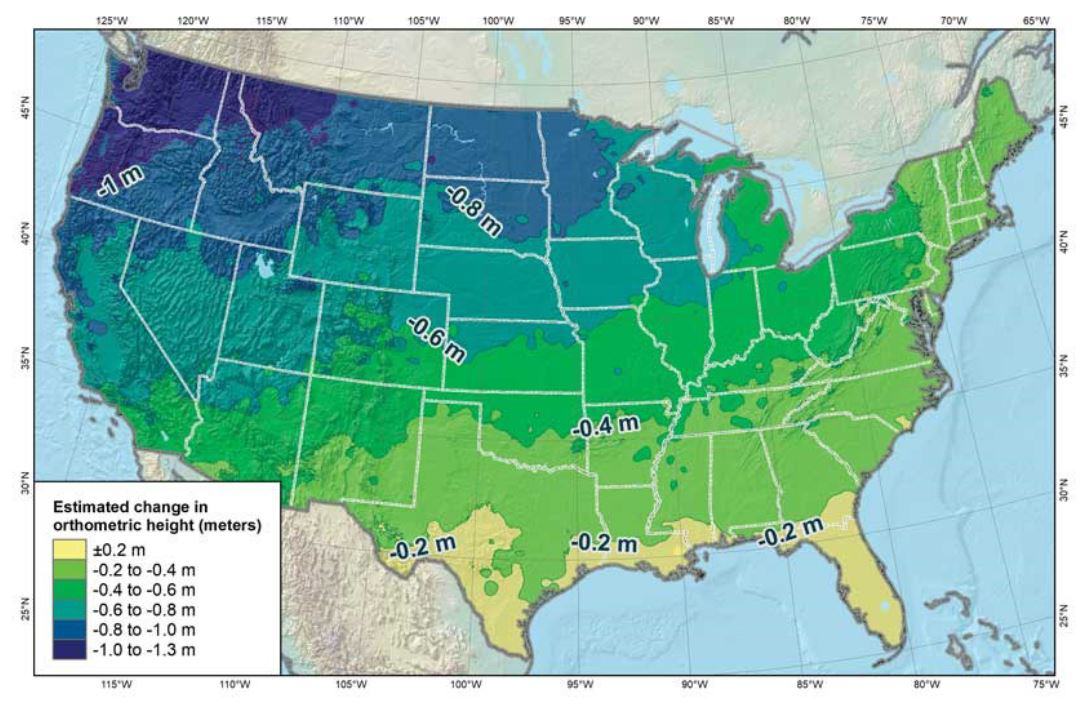
In 2008, the National Geodetic Survey (NGS) announced in its 10-year plan the replacement of the country's two national datums: North American Datum of 1983 (NAD 83), the geometric datum used mainly for horizontal positions, and the North American Vertical Datum of 1988 (NAVD 88), the vertical datum used for determining orthometric heights (elevations).
To accurately measure the surface of the earth, surveyors have spent decades creating a complex network of brass disks embedded in the ground, known as reference points or benchmark monuments, and measuring the angles and distances between them. Relating those reference points into a group forms the fundamental dataset for a survey reference frame.
The accuracy of the measurements provided by the Global Navigation Satellite System (GNSS) is our primary reason for implementing the new reference frames and a new geopotential datum that are consistent with GNSS measurements." - ESRI Winter 2019, Jim Baumann.
"NAD 83 is a static datum, meaning that coordinates are fixed. However, because the earth's tectonic plates are constantly moving, changing location values render these fixed coordinates inaccurate. Advancements in technology have also highlighted the inaccuracies of NAD 83 and NAVD 88. For example, space-based technologies and 3D positioning techniques have proven that NAD 83 is off-center by as much as two meters.
Challenges of this modernization program:
•There will no longer be a single coordinate for a single point on earth. Because surveyed coordinates will be time-dependent, over time, surveyed positions will become obsolete if they are not updated to reflect actual tectonic movement;
•All existing maps and geospatial data referenced to NAD 83 will be centered approximately two meters off the new reference frames;
•We will need to educate clients and data users on the forthcoming changes to help them better understand the change that affects their contracts and deliverable specifications." - Qassim A. Abudullah, Phd., PLS, CP
More Recent Drone Work
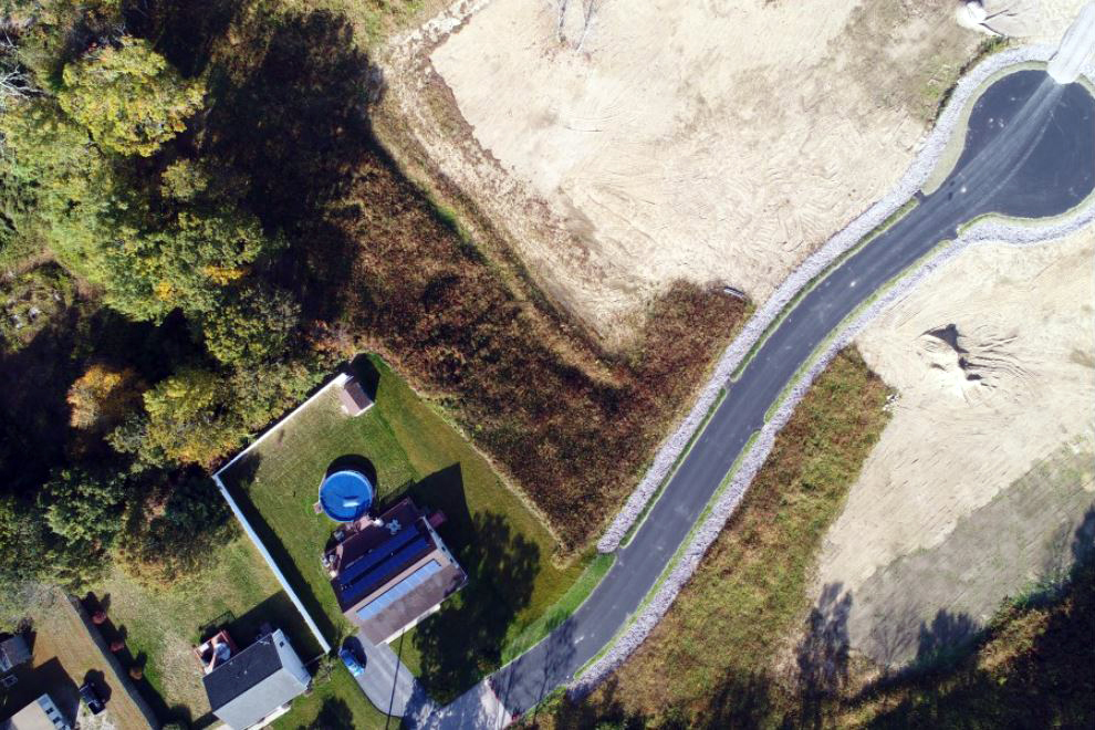
This aerial photo is from one of our most recent drone projects.
This illustrates a new roadway that was recently constructed. Note the rip-rap drainage swales on each side of the pavement clearly evidenced in the photos. Such photographic representations can add another dimension to a property's characteristics, conveying elements that might be difficult to describe otherwise.
Recent Drone Work
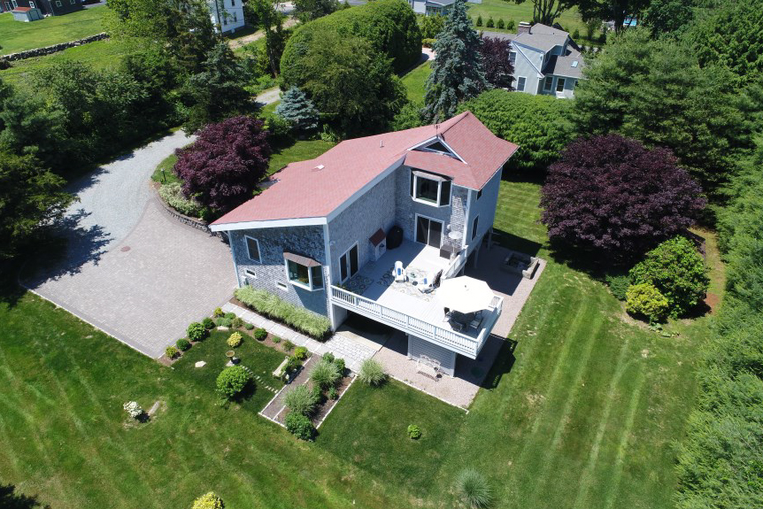
This aerial photo is from our most recent drone project.
Aerial photography adds another dimension to a property's characteristics, conveying elements that might be difficult to describe otherwise.
Call us if we can assist with your next aerial project!
Chariho Surveying Class - 30th Year
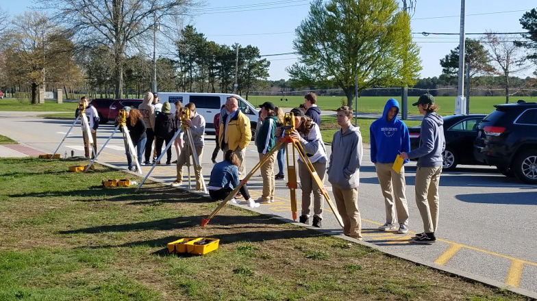
We are proud to announce that the Chariho surveying program has completed its 30th year in May 2019.
This program was originally developed by the Rhode Island Society of Professional Land Surveyors (RISPLS) and the Chariho administration as a vehicle to introduce young people to the surveying profession. Those interested in continuing along the surveying path can utilize this basis introduction to obtain entry-level employment with local surveying and engineering firms.
Some graduates of the program have gone on to join the state's surveying community, obtain advanced degrees in surveying and engineering, and attained professional registration.
The program opens with a brief introduction to the profession of land surveying, including:
• What surveyors do on a day-to-day basis
• How surveyors fit into today's project design teams
• The path to becoming a surveyor in Rhode Island
• Various advanced education options for surveying in Rhode Island and the New England states
• Statutory obligations and professional development requirements for the surveyor
• and a review of the most recent salary and benefit statistics
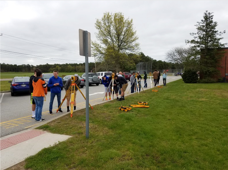
The programs goes on to include the opportunity to gain hands-on experience with the school's various surveying instrumentation.
Class participants take basic survey measurements, including the measurement of angles and distances, they develop field notes, and use that information to generate a map representing their observations. This year's class again completed their mapping exercise in AutoCad.
I appreciate the opportunity to interact with the students of instructor Jeff Domingoes and acknowledge Mr. Domingoes' gracious assistance in bringing surveying to the Chariho facility.
I've had the pleasure of being the instructor for this program since its inception in the mid-1980's and, once again, I enjoyed this opportunity to share my passion for surveying with the this year's group of young people.
Most Recent Drone Work
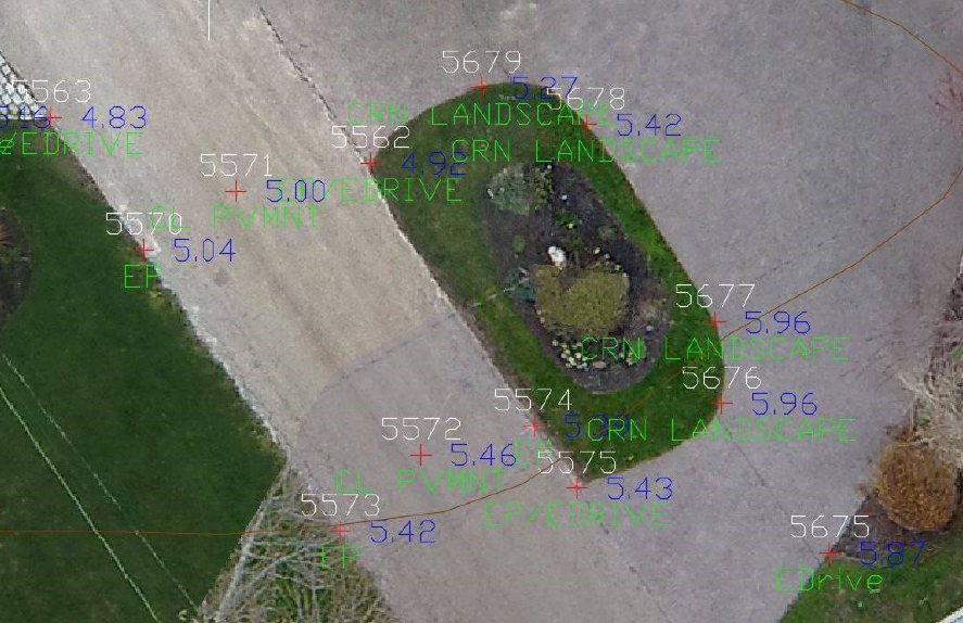
This detail is from our most recent drone mapping project.
Check out the correlation between the on-the-ground survey observations and the same features on the ortho photo!
Photography from an altitude of 350 feet.
RIDEM Freshwater Wetland Regulation Update
The Rules and Regulations Governing the Administration and Enforcement of the Freshwater Wetlands Act (July 16, 2014) have been re-codified.
This re-codification followed a standard format for the Rhode Island Code of Regulations as required by amendments to the Administrative Procedures Act (R.I. Gen. Laws § 42-35-5). The Law requires State Agencies to reformat and refile their rules by December 31, 2018 or the rules would sunset. To meet this deadline, the RIDEM and the CRMC reformated the existing Regulations with only minor and non-substantive changes to fit the prescribed format.
However, the Agencies continue to work on the revisions to the Regulations consistent with the amendments to the Freshwater Wetlands Act (R.I. Gen. Laws § 2-1-18 et seq.). The Agencies will be announcing plans to coordinate with stakeholders and begin the public process for the pro-posed revised rules in the near future.
I had the opportunity to attend a presentation on the upcoming regulation update. They appear to represent a dramatic departure from the current policies. New regulations are targeted for the end of 2019.
Stay tuned for further updates!
View the current re-codification here: https://rules.sos.ri.gov/regulations/part/250-150-15-1

University of Maine BS Surveying Mentor
The University of Maine offers a B.S. in Surveying Engineering Technology, an online course that focus-es on skills and education required for professional practice. Starting with a basic grounding in mathe-matics and the physical sciences, the student is con-currently and progressively taught a combination of surveying, practical engineering, and business.
I am pleased to be acting as a mentor for one of the students in this exciting program!
Geographic Information System (GIS) and Their Limitations
It seems every day, we're answering a question about why some GIS shows someone's boundary line running through the neighbors garage.
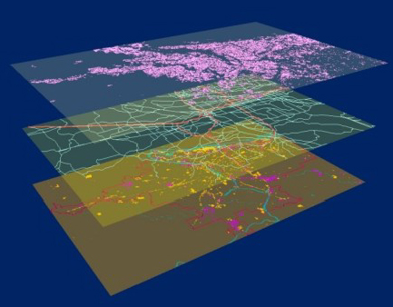
Geographic Information System (GIS) data is pulled together from a variety of sources with varying degrees of accuracy and precision.
Overlaid together, the error found within each dataset is amplified. Overlaying a parcel database that may have an accuracy of +/-10 feet onto aerial imagery with an accuracy of +/- 30 feet can lead to features ending up over 80 feet away from their true point.
J.B. Guyton, Nov., 19, 2010
RIDEM Septic System Records & Resources
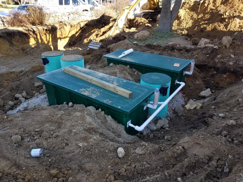
Over 35% of homes and businesses in Rhode Island are served by on-site wastewater treatment (septic) systems. To help enhance customer service and streamline processes, DEM offers several tools and resources for septic system per-mitting information. Visit our web page for:
• Factsheets and guidance for homeowners
• Answers to frequently asked questions
• Lists of licensed septic professionals
• Access to DEM’s septic system records
DEM has records of most septic system permits from 1968 to present. Depending on when the system was installed, records may be available online or a physical copy of the file may be available in the DEM archives. Online records are separated into two categories: before 1990 and after 1990.
DEM septic system records are filed by the assessor's plat and lot number when the system was installed. Check with the property's local Tax Assessor for this in-formation, as well as the subdivision number, the original property owner's name, and the year the property was first developed.
http://www.dem.ri.gov/programs/water/owts/
Mayan "Megalopolis" Discovered with LiDar
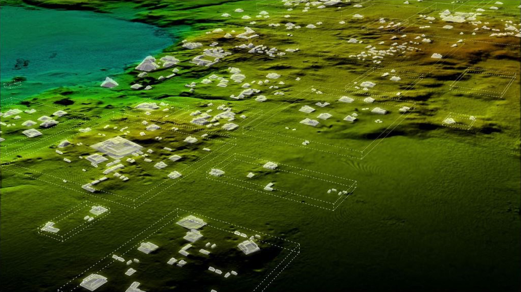
LiDar and UAV technologies were combined to recently uncover hundreds of previously unknown Mayan ruins in the Guatemalan rainforest. Flying above the rainforest, the LiDar lasers penetrated the canopy to collect almost a million points per second from the forest floor, giving archaeologists a ‘bare earth’ view of the structures underneath. The project was conducted by the University of Houston’s National Center for Airborne Laser Mapping. - GPS World, March 2018
Embracing UAS Technology for Surveying
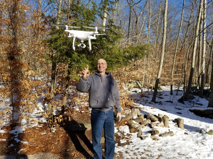
Our firm has recently committed to UAS (Unmanned Aerial System) technology with the acquisition of a DJI Phantom 4 Pro drone.
We're enthusiastic about implementing this new technology and bringing it to bear on our client's needs.
We anticipate the capability to take video and still images of sites and perform aerial photogrammetry to acquire both topographic and planimetric data.
In addition:
• Site photography and 4K video for presentations
• ”Point of Interest” fly-over for real estate sales presentations and marketing
• Aerial inspection of towers, lighting, and utility elements
• Project progress documentation
• Volume analysis
Call us to discuss this exciting new addition to our array of surveying instrumentation.
New RIDEM Policy - In Step with the Times
On 11-16-2017, the Rhode Island Department of Environmental Management, Office of Water Resources - OWTS Program announced their new policy regarding the review of OWTS applications.
To reduce permit processing times and improve customer service effective December 1, 2017 the DEM OWTS Permitting Staff will begin emailing design review comments to designers.
Email Process
If an application is found deficient, an email will be sent to the designer summarizing the revisions that are required. If revisions to the tri-color application form or another application form are required these forms will continue to be mailed out via regular mail in addition to the email notification. If revisions to an application form are not required, no regular mail will be sent, only an email notification.
Please Include Your Email on the OWTS Application Form
For this new process to be implemented we are encouraging all designers to provide DEM OWTS with their email address on the application form prior to submittal. If an email address is not provided on the application form the standard mail process will be utilized.
We applaud this new RIDEM policy and see it as in step with the way business is conducted today. The previous, and archaic, policy of mailing the entire deficient application package back to the designer needed to be relegated to the history books.
We trust that this will be one step toward more efficient regulatory review here in Rhode Island.
28th Chariho Survey Class Completed
We are proud to announce that the Chariho surveying program has completed its 28th year in May 2016.
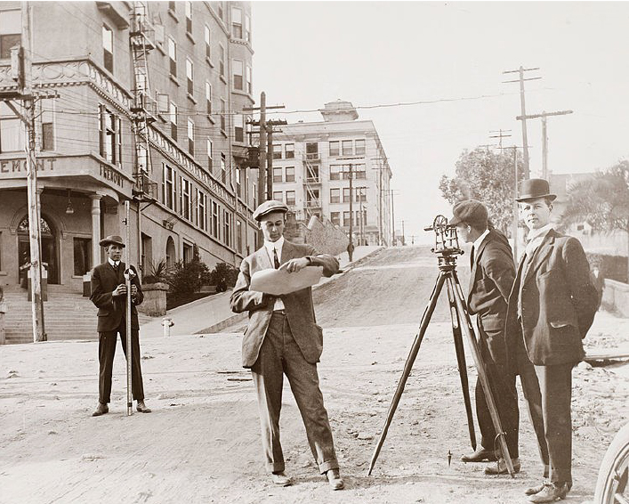
This program was originally developed by the Rhode Island Society of Professional Land Surveyors (RISPLS) and the Chariho administration as a vehicle to introduce young people to the surveying profession. Those interested in continuing along the surveying path can utilize this basis introduction to obtain entry-level employment with local surveying and engineering firms.
Some graduates of the program have gone on to join the state's surveying community, obtain advanced degrees in surveying and engineering, and attained professional registration.
The program opens with a brief introduction to the profession of land surveying, including:
- What surveyors do on a day-to-day basis
- How surveyors fit into today's project design teams
- The path to becoming a surveyor in Rhode Island
- Various advanced education options for surveying in Rhode Island and the New England states
- Statutory obligations and professional development requirements for the surveyor
- A review of the most recent salary and benefit statistics.
Class participants take basic survey measurements, including the measurement of angles and distances, they develop field notes, and use that information to generate a map representing their observations.
I appreciate the opportunity to interact with the students of instructor Jeff Domingoes and acknowledge Mr. Domingoes' gracious assistance in bringing surveying to the Chariho facility.
I've had the pleasure of being the instructor for this program since its inception in the mid-1980's and, once again, I enjoyed this opportunity to share my passion for surveying with the this year's group of young people.
What is Mean High Water?
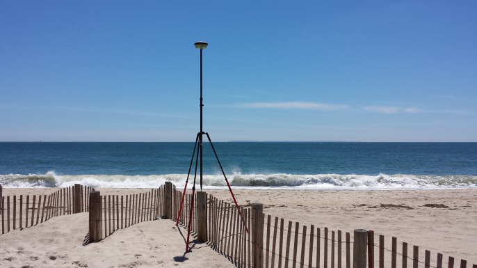
With the recent court ruling that confirms the extension of private ownership of beachfront property to the mean high water (MHW) line (specifically in the Misquamicut area of Westerly, RI), the inevitable question from both coastal property owners and beach visitors will be "where is the mean high water line"?
While there are several "rule of thumb" gauges for estimating the MHW line, the only precise and accurate method is to place the MHW elevation on the shoreline, typically utilizing survey techniques.
It should be noted that even this accepted technique is only valid for a relatively short period of time as any change in the shoreline configuration (from storms or tidal actions) will change the horizontal location of the MHW elevation.
Still, we believe that RTK GPS technology offers the most cost-effective solution to placing this critical feature on the shoreline. Call us if we can provide this service to you or your clients.
Beastcam
A non-profit company called Digital Life has begin the ambitious project of building a database of digital scans of every animal on Earth...a modern day Noah’s Ark. Their goal "...to preserve the heritage of life on Earth through creating and sharing high-quality and accurate 3D models of livings organisms."
The Beastcam technology is a multi-camera 3D modeling platform that can rapidly capture 3D models of everyday objects, including living animals.
This technology creates high-quality 3D models through photogrammetry—the integration of 2D images to create 3D models.
Digital Life is a non-profit initiative within the University of Massachusetts at Amherst that creates digital 3D models of living organisms to support wildlife conservation, science and education.
Digital Life’s models are freely available online for public viewing. Visit their website.
Highest Wave on Record
[From GPS World, January 2017]. The World Meteorological Organization announced the highest wave on record: a behemoth that towered 19 meters (62.3 feet) above the North Atlantic. Examination of data sent by an automated buoy showed the monster wave rose on February 4, 2013, at a remote spot between Britain and Iceland.
Automated buoys are vital tools for oceanographers, sending back data on sea currents, temperature and swells for seafarers, climate researchers and others.
Many buoys are GPS-equipped to measure water height. "We suspect this one was, though it has not been confirmed."

New RIDEM Guidance Documents
RIDEM has announced several new and updated Soil Erosion and Sediment Control Guidance Documents and Planning Tools.
Updated! RI Soil Erosion and Sediment Control Handbook – July 2016
New! RI Soil Erosion and Sediment Control Field Guide
New! SESC Plan Template for Small Sites (less than 1 Acre) with Educational Brochure
New! DEM Webpage Dedicated to Soil Erosion and Sediment Control
Alfred W. DiOrio, RLS, Inc.
Professional Land Surveyors and Land Use Consultants
P.O. Box 999
Ashaway, Rhode Island 02804-0009
(401) 377-8124


