



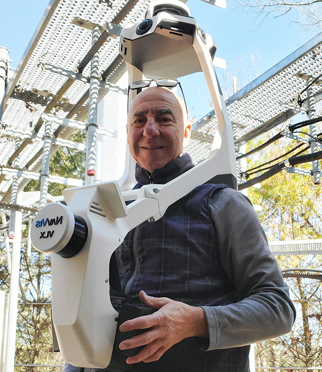
NavVis VLX3 is the industry-leading, wearable dynamic scanning system that efficiently delivers comprehensive, highly detailed reality capture data to laser scanning professionals and surveyors for large, complex sites, both indoor and outdoor.
From design to deliverable, NavVis VLX3 is optimized to offer unparalleled results. Robust SLAM (Simultaneous Localization and Mapping) coupled with state of the art system and processing software, NavVis VLX3 generates data that preserves original details, detects and removes dynamic objects, minimizes drift and captures high detail at range.
How it works: You walk through a space while the device captures hundreds of thousands of laser points per second. The device combines LiDar (Light Detection and Ranging), IMU (Inertial Measurement Units), and sometimes cameras to calculate movement and geometry.
Operation range 50m
Points per second 1,280,000
Accuracy 5mm
CERTA 2D
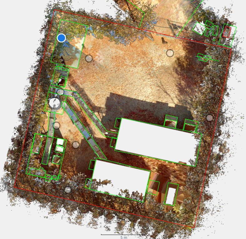
This image is a 2D (top down) view of a point cloud derived from a VLX3 session. Some linework has been added to enhance the various site elements. This entire cell tower site was captured in 11 minutes.
CERTA Point Cloud
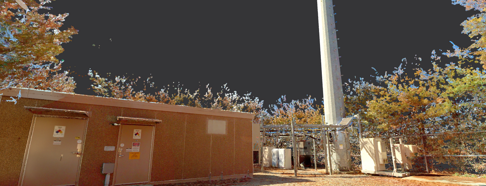
This image is a 3D view of the same point cloud in CERTA 2D. The 'mosaic' is actually a collection of millions of individual points, each with a X,Y,Z value from which precise measurements can be made.
Silva 2D
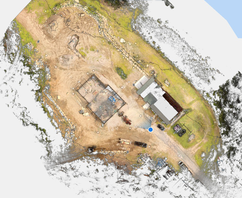
This image is a 2D (top down) view of a point cloud derived from a VLX3 session. This is an approximately 2 acre site under construction. Note the existing dwelling and garage being built. This entire site was captured in 22 minutes.
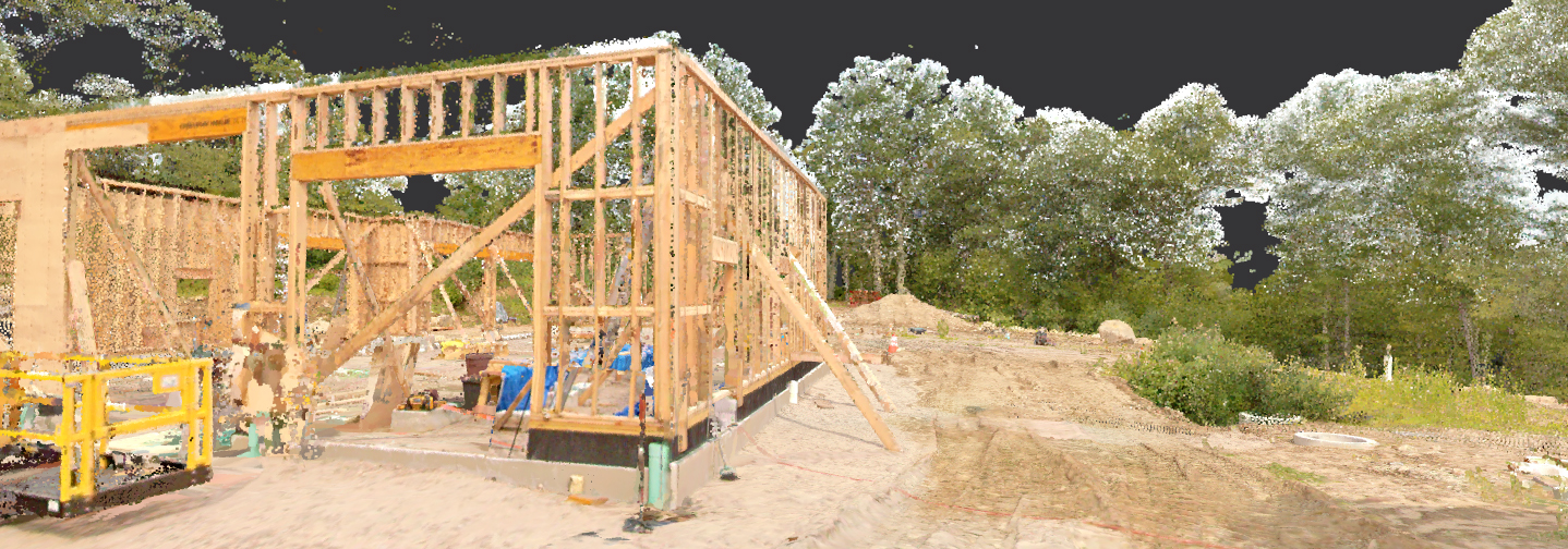
Silva Point Cloud
This image is a 3D view of the same point cloud in Silva 2D. The 'mosaic' is actually a collection of millions of individual points, each with a X,Y,Z value from which precise measurements can be made. Note the detail on the garage construction.
Alfred W. DiOrio, RLS, Inc.
Professional Land Surveyors and Land Use Consultants
P.O. Box 999
Ashaway, Rhode Island 02804-0009
(401) 377-8124